
Mapanas
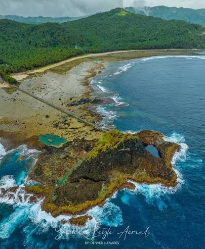
Mapanas, Northern Samar is a coastal municipality covering 12,170 hectares across 13 barangays with a population of 14,264. Positioned along the renowned "Tuna Highway," Mapanas stands as one of the province's tuna capitals, where local fishermen carry on centuries of fishing tradition. The town features a coastal landscape filled with rugged rock formations, pristine white sand beaches, natural tidal pools, and hidden waterfalls within thick green forests. Key attractions include the heartshaped azure blue lagoon at Pinusilan Rock Formation (a key area of the Northern Samar GeoPark accessible via a bridge from Naputad Beach), the 20-meter-tall Mayong Payong Rock Formation, and the white sand shorelines of Naputad Beach and Luyang Rock Formation. The town is also known for its local delicacy isi (or huruhagdan – a traditional treat made of ground rice, sugar, and coconut milk), offering visitors activities like freediving, snorkeling, paddleboarding, and forest hiking.
How to get there?
To get to Mapanas, take a public van bound for Mapanas from the Catarman Land Transport Terminal via the Samar Pacific Coastal Road. Travelers coming from Eastern Samar can also reach the town through the National Highway connecting Arteche and Lapinig.
Attractions
Discover the places, landscapes, and local destinations that showcase the character and identity of Mapanas.
Where to Eat
Discover local restaurants, eateries, cafés, and food places where visitors can enjoy meals while exploring Mapanas.
Where to Stay
Find accommodations, inns, homestays, resorts, and other places where visitors can stay during their visit to Mapanas.
What to Do
Explore Mapanas through its natural environment, local culture, coastal landscapes, and community experiences.
Map of Mapanas
Explore the location of Mapanas, Northern Samar, and plan your journey.